Understanding Air Masses: A Beginner’s Guide
Weather is a daily topic of conversation for many, but have you ever wondered what causes those weather changes? One of the fundamental factors shaping our weather is air masses. Understanding air masses is like unlocking the secrets of the atmosphere, allowing us to comprehend why it rains one day and is sunny the next. In this beginner’s guide, we’ll explore what air masses are, how they form, and the role they play in creating the weather we experience.
What are Air Masses?

Imagine a giant bubble of air floating over the Earth’s surface, covering vast areas with consistent temperature and humidity characteristics. That’s essentially what an air mass is. These immense bodies of air form when a large mass of air remains stagnant over a specific region for an extended period, allowing it to take on the temperature and moisture properties of that area.
The origin of air masses
The origin of air masses can be traced back to the interaction between the Earth’s surface and the atmosphere. Several factors influence the formation of air masses, including temperature gradients, moisture content, and geographical features. Here’s a breakdown of how air masses originate:
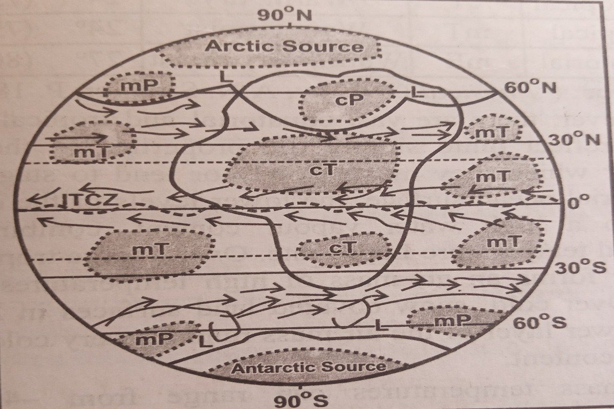
- Source Regions: Air masses typically originate in specific geographic areas known as source regions. These regions are characterized by relatively uniform surface conditions, such as temperature, humidity, and terrain. Source regions can include large bodies of water, such as oceans or seas, as well as landmasses with consistent surface features, like deserts or polar ice caps.
- Surface Heating and Cooling: The heating and cooling of the Earth’s surface play a crucial role in air mass formation. During the day, the Sun heats the Earth’s surface unevenly, creating temperature variations across different regions. This temperature contrast leads to the development of air masses with distinct thermal characteristics. For example, warm air masses form over heated land surfaces, while cool air masses originate over cooler ocean waters or polar regions.
- Atmospheric Circulation Patterns: Atmospheric circulation patterns, driven by the Earth’s rotation and variations in solar heating, also contribute to the formation of air masses. Prevailing winds transport air masses from their source regions to other areas, where they interact with different air masses or encounter geographical barriers. For instance, the trade winds carry warm, moist air masses from the tropics to higher latitudes, while the polar jet stream can transport cold air masses from polar regions to lower latitudes.
- Moisture Sources: The moisture content of air masses is influenced by nearby water bodies, such as oceans, seas, or large lakes. Air masses that originate over water surfaces tend to be more humid, while those originating over land surfaces are usually drier. The interaction between air masses with varying moisture content can lead to the formation of clouds and precipitation.
- Geographical Features: Geographical features, such as mountains, valleys, and coastlines, can modify the characteristics of air masses as they move across the Earth’s surface. For example, mountains can act as barriers, forcing air masses to rise and cool, which may result in the formation of clouds and precipitation on the windward side. In contrast, valleys and plains may experience temperature inversions, where cool air becomes trapped near the surface, leading to stable atmospheric conditions.
Types of Air Masses
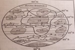
Air masses come in different flavors, each with its own set of characteristics and origins. Here are the primary types:
- Maritime Tropical (mT): These air masses originate over warm ocean waters in the tropics or subtropics. As they move over land, they bring warm, moist air, often leading to humid conditions and heavy rainfall.
- Maritime Polar (mP): Maritime polar air masses form over cold ocean surfaces in high latitudes. They are moist and relatively cool, causing cloudy skies and cool temperatures when they move inland.
- Continental Tropical (cT): Originating over hot and dry land regions, such as deserts, continental tropical air masses are warm and dry. They bring hot, arid conditions when they move into other areas.
- Continental Polar (cP): These air masses originate over cold land regions at high latitudes. They are cold and dry, resulting in frigid temperatures and low humidity levels.
Characteristics of Air Masses
Each air mass has its own unique set of characteristics that influence the weather patterns of the regions they affect:
- Temperature: The temperature of an air mass depends on its source region. Whether it’s scorching hot or freezing cold, the temperature plays a significant role in determining the weather conditions.
- Humidity: Humidity levels within an air mass vary depending on whether it originated over land or water. This affects the likelihood of precipitation and cloud formation.
- Stability: Air masses can be stable or unstable, affecting the vertical movement of air and the formation of weather phenomena like thunderstorms and clouds.
Movement of Air Masses
Air masses are not stationary; they are constantly on the move, driven by the Earth’s rotation and atmospheric circulation patterns. Prevailing winds carry air masses from their source regions to other areas, where they interact with different air masses or encounter geographical features like mountains and coastlines.
Weather Effects of Air Masses
The collision of air masses can lead to changes in weather conditions, such as:
- Frontal Systems: When two air masses with different characteristics meet, they form a boundary known as a front. This can trigger the development of weather systems like thunderstorms, rain, and temperature changes.
- Precipitation: The interaction of warm, moist air masses with cooler air can lead to the formation of clouds and precipitation. The type and intensity of precipitation depend on the temperature and moisture content of the air masses involved.
- Temperature Changes: The arrival of a new air mass can cause significant changes in temperature. For example, a cold front can bring a sudden drop in temperature, while a warm front can usher in warmer conditions.
Importance in Weather Forecasting
Understanding air masses is crucial for weather forecasting. Meteorologists analyze the characteristics and movements of air masses to predict changes in weather patterns, such as temperature fluctuations, precipitation, and storm development. By monitoring air masses, forecasters can provide valuable information to the public, helping people prepare for and respond to weather events.
Conclusion
Air masses are like the building blocks of weather, shaping the conditions we experience every day. By understanding the different types of air masses, their characteristics, and how they interact, we gain insight into the complex dynamics of the atmosphere. Whether it’s a sunny day at the beach or a thunderstorm rolling in, air masses are at the heart of it all, reminding us of the interconnectedness of Earth’s systems. So the next time you look up at the sky, remember that it’s not just a mass of blue; it’s a canvas painted by the movements of air masses across the globe.


